2018
SO4408 : National Cycle Network route 423 direction sign in Coed-y-fedw, Monmouthshire
taken 6 years ago, near to Pen-y-Clawdd, Monmouthshire/Sir Fynwy, Wales
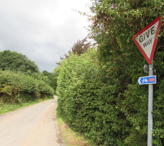
National Cycle Network route 423 direction sign in Coed-y-fedw, Monmouthshire
On the right here. Link The Sustrans website states that Route 423 follows the former Regional Route 30 and the Peregrine Path from Cwmbran to Ross-on-Wye via Monmouth.
The National Cycle Network
The National Cycle Network is a network of cycle routes. It was created by the charity Sustrans Link
(Sustainable Transport), aided by a National Lottery grant.
Many routes aim to minimise contact with motor traffic, though 70% of them are on roads. In some cases the NCN uses pedestrian routes, disused railways, minor roads, canal towpaths, or traffic-calmed routes in towns and cities.
 Map © Crown Copyright")
TIP: Click the map for more Large scale mapping
- Grid Square
- SO4408, 42 images (more nearby 🔍)
- Photographer
- Jaggery (more nearby)
- Date Taken
- Monday, 27 August, 2018 (more nearby)
- Submitted
- Monday, 27 August, 2018
- Subject Location
-
OSGB36:
 SO 4433 0873 [10m precision]
WGS84: 51:46.4675N 2:48.4953W - Camera Location
-
OSGB36: SO 4433 0873
- View Direction
- NORTH (about 0 degrees)