2018
SU0036 : Trees, Bilbury Farm
taken 6 years ago, near to Wylye, Wiltshire, England
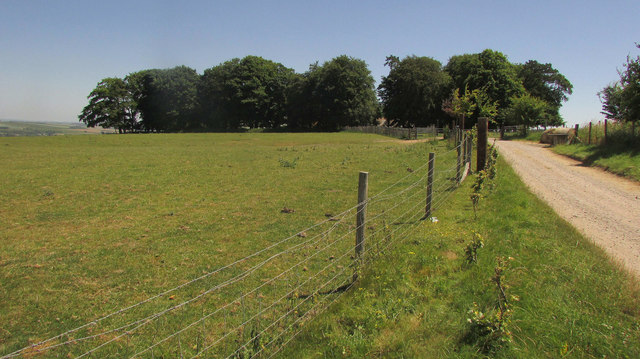
Trees, Bilbury Farm
Bilbury Rings surround the farm and trees, and one earthwork rampart is visible on the left in front of the trees. "Iron Age multivallate hillfort enclosing an area of 17.5 acres ... The hillfort encloses an irregular-shaped area and was late Iron Age and Roman in date". Link .
.
 Map © Crown Copyright")
TIP: Click the map for more Large scale mapping
- Grid Square
- SU0036, 17 images (more nearby 🔍)
- Photographer
- Derek Harper (more nearby)
- Date Taken
- Saturday, 30 June, 2018 (more nearby)
- Submitted
- Sunday, 9 September, 2018
- Subject Location
-
OSGB36:
 SU 0093 3628 [10m precision]
WGS84: 51:7.5480N 1:59.2854W - Camera Location
-
OSGB36: SU 0084 3630
- View Direction
- East-southeast (about 112 degrees)