2018
SN7377 : Grassland on the edge of the Rheidol gorge
taken 6 years ago, near to Devil's Bridge, Ceredigion/Sir Ceredigion, Wales
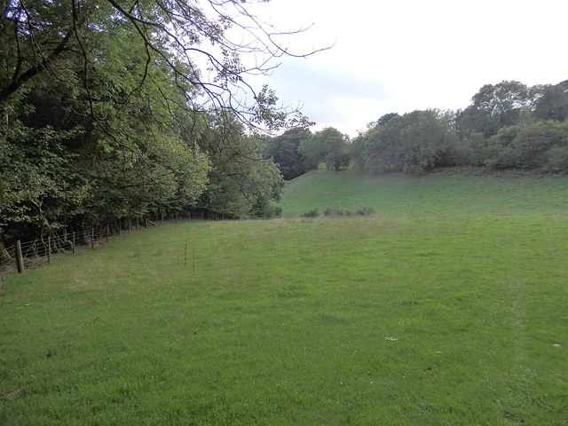
Grassland on the edge of the Rheidol gorge
The path (indistinct in places) linking Pontarfynach/Devil's Bridge with the bottom of the gorge follows the boundary between the wooded slope and the relatively flat grassland on the plateau. The view here is towards Pontarfynach.
 Map © Crown Copyright")
TIP: Click the map for more Large scale mapping
- Grid Square
- SN7377, 659 images (more nearby 🔍)
- Photographer
- Rudi Winter (more nearby)
- Date Taken
- Monday, 13 August, 2018 (more nearby)
- Submitted
- Sunday, 9 September, 2018
- Subject Location
-
OSGB36:
 SN 7323 7725 [10m precision]
WGS84: 52:22.7143N 3:51.8282W - Camera Location
-
OSGB36: SN 7317 7736
- View Direction
- South-southeast (about 157 degrees)