2017
NN6971 : Layby number 70, Southbound A9
taken 7 years ago, near to Wade Stone, The [other Features], Perth And Kinross, Great Britain
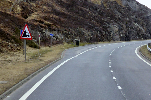
Layby number 70, Southbound A9
As you travel along the A9, there is a series of laybys at fairly regular intervals on both sides of the road between Perth and Cromarty Bridge. These laybys are numbered consecutively from south to north. The layby furthest north is number 200. Layby 71 is on the southbound carriageway near to the Wade Stone. The "falling rocks" sign doesn't inspire much confidence for parking here!
See other images of Numbered Laybys on the A9
The A9
The A9 is a strategic link between the Highlands of Scotland and the Central Belt. Running for 273 miles, it is the longest road in Scotland and the fifth-longest A-road in the United Kingdom. Historically it was the main road between Edinburgh and John o' Groats but its importance has been eclipsed somewhat in the south by the A90 across the Forth Road Bridge and the M90 motorway, which now links Edinburgh more directly with Perth, and the M9, which is now the main road between Edinburgh and Bridge of Allan.
 Map © Crown Copyright")
TIP: Click the map for more Large scale mapping
- Grid Square
- NN6971, 33 images (more nearby 🔍)
- Photographer
- David Dixon (more nearby)
- Date Taken
- Friday, 7 April, 2017 (more nearby)
- Submitted
- Monday, 10 September, 2018
- Subject Location
-
OSGB36:
 NN 693 716 [100m precision]
WGS84: 56:49.0764N 4:8.5008W - Camera Location
-
OSGB36: NN 692 716
- View Direction
- East-southeast (about 112 degrees)