2018
NT9623 : Track through plantation on Pinkie Shank
taken 6 years ago, near to Langleeford, Northumberland, England
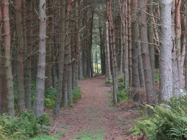
Track through plantation on Pinkie Shank
This track runs from the Backwood Burn through the plantation and, whilst it is shown on the Ordnance Survey map as extending beyond the plantation, it is impossible to follow this beyond the western boundary. For a selection of detailed free to download walking routes in the area visit Link
 Map © Crown Copyright")
TIP: Click the map for more Large scale mapping
- Grid Square
- NT9623, 41 images (more nearby 🔍)
- Photographer
- Geoff Holland (more nearby)
- Date Taken
- Thursday, 13 September, 2018 (more nearby)
- Submitted
- Friday, 14 September, 2018
- Subject Location
-
OSGB36:
 NT 9628 2350 [10m precision]
WGS84: 55:30.3156N 2:3.6270W - Camera Location
-
OSGB36: NT 9620 2347
- View Direction
- East-northeast (about 67 degrees)