2018
NY7968 : Hadrian's Wall north-east of Housesteads
taken 6 years ago, 4 km N of Bardon Mill, Northumberland, England
This is 1 of 23 images, with title starting with Hadrian's Wall in this square
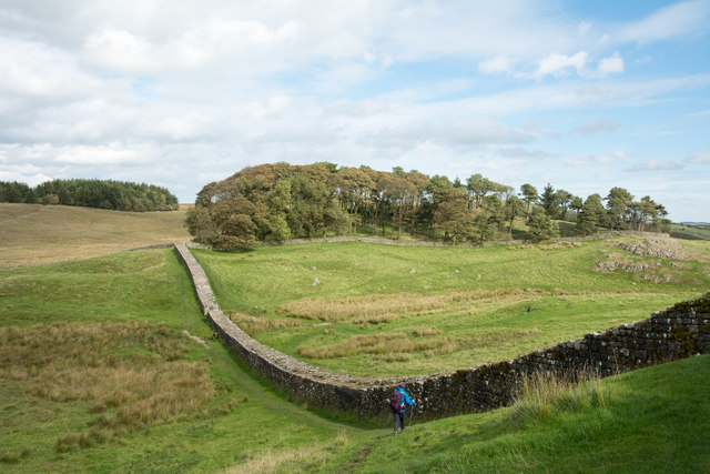
Hadrian's Wall north-east of Housesteads
The Roman wall is seen as it descends from Vercovicium, the Roman fort at Housesteads. The walker is on the path which follows the route of Hadrian's Wall, now a national trail.
 Map © Crown Copyright")
TIP: Click the map for more Large scale mapping
- Grid Square
- NY7968, 168 images (more nearby 🔍)
- Photographer
- Trevor Littlewood (more nearby)
- Date Taken
- Tuesday, 25 September, 2018 (more nearby)
- Submitted
- Wednesday, 26 September, 2018
- Subject Location
-
OSGB36:
 NY 7906 6893 [10m precision]
WGS84: 55:0.8685N 2:19.7394W - Camera Location
-
OSGB36: NY 7903 6887
- View Direction
- North-northeast (about 22 degrees)