2018
SS1297 : The causeway to St Margaret's Island
taken 6 years ago, near to Penally, Pembrokeshire/Sir Benfro, Wales
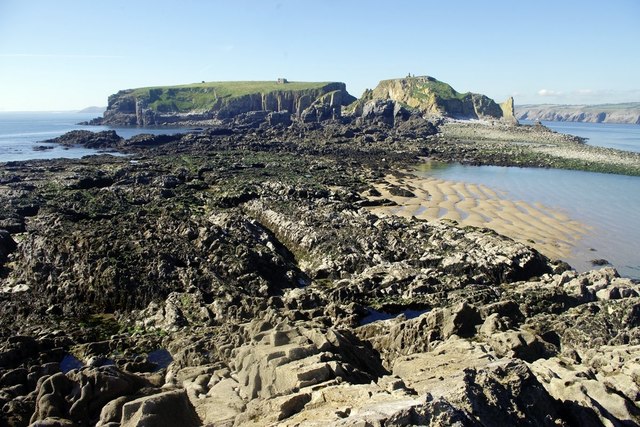
The causeway to St Margaret's Island
This is a dangerous causeway as it has two deep cut-off channels. Drownings have occurred when people have found themselves half-way across and cut off in front and behind.
 Map © Crown Copyright")
TIP: Click the map for more Large scale mapping
- Grid Square
- SS1297, 11 images (more nearby 🔍)
- Photographer
- Alistair Hare (more nearby)
- Date Taken
- Thursday, 27 September, 2018 (more nearby)
- Submitted
- Thursday, 27 September, 2018
- Subject Location
-
OSGB36:
 SS 1236 9723 [10m precision]
WGS84: 51:38.5490N 4:42.7959W - Camera Location
-
OSGB36: SS 1253 9717
- View Direction
- West-northwest (about 292 degrees)