2018
HU3368 : Mavis Grind, Rainbow over the Atlantic
taken 6 years ago, near to Islesburgh, Mainland, Shetland Islands, Scotland
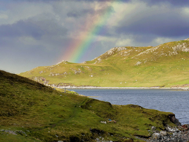
Mavis Grind, Rainbow over the Atlantic
Mavis Grind is a narrow strip of land (isthmus), barely 100 foot wide at its narrowest point, which separates the Atlantic Ocean from the North Sea and also joins a large chunk of the north-west mainland to the rest of mainland Shetland. Without it, there would be at least one more Shetland Island.
Researchers believe the Vikings moved their boats across land in order to avoid the hazardous journey round the tip of mainland Shetland (Link BBC News). The name Mavis Grind derives from the Old Norse: Mæfeiðs grind or the Norwegian Mæveiðs grind meaning "gate of the narrow isthmus".
Since then, various cargoes have made the crossing but the route is probably best known as a boat draa where mariners avoided the long and, at times dangerous, journey around north mainland by hauling their vessel overland instead. The crossing was used regularly until the 1950s.
An information board at the site claims that Mavis Grind is possibly the only place in the United Kingdom where you can stand at the side of the Atlantic Ocean and throw a stone overland into the North Sea. I did not try this (not least because if the stone fell short, it could hit any passing traffic on the A970 which crosses the isthmus).
See other images of Mavis Grind
Researchers believe the Vikings moved their boats across land in order to avoid the hazardous journey round the tip of mainland Shetland (Link
Since then, various cargoes have made the crossing but the route is probably best known as a boat draa where mariners avoided the long and, at times dangerous, journey around north mainland by hauling their vessel overland instead. The crossing was used regularly until the 1950s.
An information board at the site claims that Mavis Grind is possibly the only place in the United Kingdom where you can stand at the side of the Atlantic Ocean and throw a stone overland into the North Sea. I did not try this (not least because if the stone fell short, it could hit any passing traffic on the A970 which crosses the isthmus).
See other images of Mavis Grind
 Map © Crown Copyright")
TIP: Click the map for more Large scale mapping
- Grid Square
- HU3368, 31 images (more nearby 🔍)
- Photographer
- David Dixon (more nearby)
- Date Taken
- Sunday, 23 September, 2018 (more nearby)
- Submitted
- Saturday, 29 September, 2018
- Subject Location
-
OSGB36:
 HU 337 684 [100m precision]
WGS84: 60:23.9292N 1:23.3511W - Camera Location
-
OSGB36: HU 339 683
- View Direction
- West-northwest (about 292 degrees)