2018
HU2478 : St Magnus Bay
taken 6 years ago, near to Braehoulland, Mainland, Shetland Islands, Scotland
St Magnus Bay
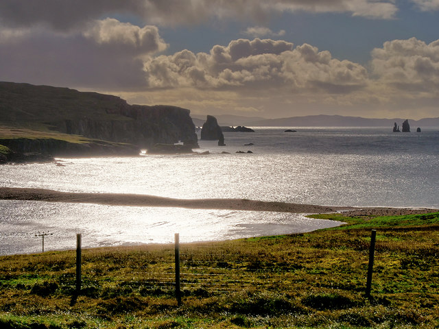
Looking down towards Braewick Loch from the Braewick Cafe. Braewick Loch is separated from the sea by a narrow strip of shingle. The cliffs of "The Neap" are in the distance and there are several sea stacks (including HU2675 : The Drongs) in the bay.
 Map © Crown Copyright")
TIP: Click the map for more Large scale mapping
- Grid Square
- HU2478, 47 images (more nearby 🔍)
- Photographer
- David Dixon (more nearby)
- Date Taken
- Sunday, 23 September, 2018 (more nearby)
- Submitted
- Sunday, 30 September, 2018
- Subject Location
-
OSGB36:
 HU 247 784 [100m precision]
WGS84: 60:29.3441N 1:33.0432W - Camera Location
-
OSGB36: HU 244 789
- View Direction
- Southeast (about 135 degrees)