2018
TQ4179 : Thames Barrier
taken 6 years ago, near to London City Airport, Newham, England
This is 1 of 71 images, with title Thames Barrier in this square
Thames Barrier
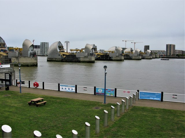
The Thames Barrier spans 520 metres across the River Thames near Woolwich, and it protects 125 square kilometres of central London. Each main gate weighs 3,300 tonnes. According to the Government website, the Thames Barrier has been closed 182 times since it became operational in 1982 (correct as of February 2018). Of these closures, 95 were to protect against tidal flooding and 87 were to protect against combined tidal/fluvial flooding. This view is from the south bank of the River Thames.
 Map © Crown Copyright")
TIP: Click the map for more Large scale mapping
- Grid Square
- TQ4179, 520 images (more nearby 🔍)
- Photographer
- G Laird (more nearby)
- Date Taken
- Saturday, 22 September, 2018 (more nearby)
- Submitted
- Monday, 1 October, 2018
- Subject Location
-
OSGB36:
 TQ 4149 7952 [10m precision]
WGS84: 51:29.8152N 0:2.2136E - Camera Location
-
OSGB36: TQ 4166 7931
- View Direction
- Northwest (about 315 degrees)