2018
NO4794 : Flood damage, Glen Tanar
taken 6 years ago, 4 km ESE of Greystone, Aberdeenshire, Scotland
This is 1 of 2 images, with title Flood damage, Glen Tanar in this square
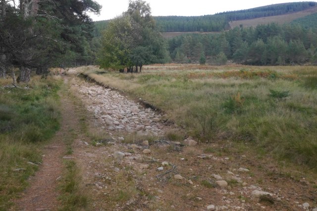
Flood damage, Glen Tanar
In the floods, Summer and Winter 2015, a lot of damage was done to roads as well as homes and businesses. Here the road has been lifted away leaving a deep hole. A new road has been built further from the river. There is still a good path here.
 Map © Crown Copyright")
TIP: Click the map for more Large scale mapping
- Grid Square
- NO4794, 19 images (more nearby 🔍)
- Photographer
- Richard Webb (more nearby)
- Date Taken
- Sunday, 23 September, 2018 (more nearby)
- Submitted
- Wednesday, 3 October, 2018
- Subject Location
-
OSGB36:
 NO 4719 9445 [10m precision]
WGS84: 57:2.2861N 2:52.3103W - Camera Location
-
OSGB36: NO 4718 9445
- View Direction
- EAST (about 90 degrees)