2018
TF2157 : Tattershall Castle: aerial 2018
taken 6 years ago, near to Tattershall, Lincolnshire, England
This is 1 of 2 images, with title Tattershall Castle: aerial 2018 in this square
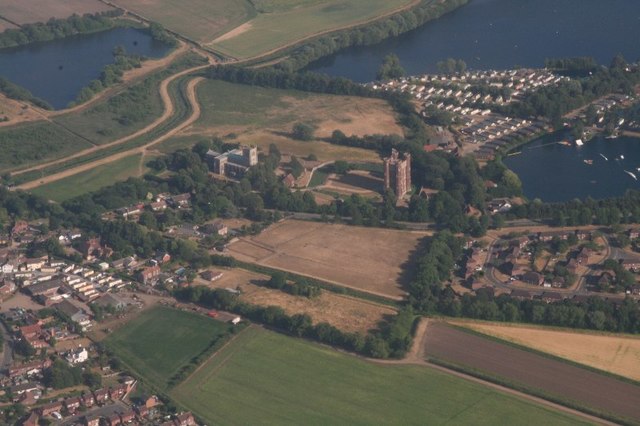
Tattershall Castle: aerial 2018
 Map © Crown Copyright")
TIP: Click the map for more Large scale mapping
- Grid Square
- TF2157, 405 images (more nearby 🔍)
- Photographer
- Chris (more nearby)
- Date Taken
- Wednesday, 11 July, 2018 (more nearby)
- Submitted
- Sunday, 7 October, 2018
- Subject Location
-
OSGB36:
 TF 212 575 [100m precision]
WGS84: 53:6.0668N 0:11.4368W - Camera Location
-
OSGB36: TF 199 582
- View Direction
- East-southeast (about 112 degrees)