2018
TF4757 : Crop marks in field south of Scaldgate, Wainfleet: aerial 2018
taken 6 years ago, near to Wainfleet Bank, Lincolnshire, England
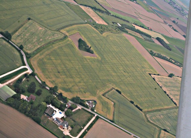
Crop marks in field south of Scaldgate, Wainfleet: aerial 2018
 Map © Crown Copyright")
TIP: Click the map for more Large scale mapping
- Grid Square
- TF4757, 18 images (more nearby 🔍)
- Photographer
- Chris (more nearby)
- Date Taken
- Wednesday, 11 July, 2018 (more nearby)
- Submitted
- Friday, 12 October, 2018
- Subject Location
-
OSGB36:
 TF 4716 5767 [10m precision]
WGS84: 53:5.7570N 0:11.7788E - Camera Location
-
OSGB36: TF 4565 5860
- View Direction
- East-southeast (about 112 degrees)