2018
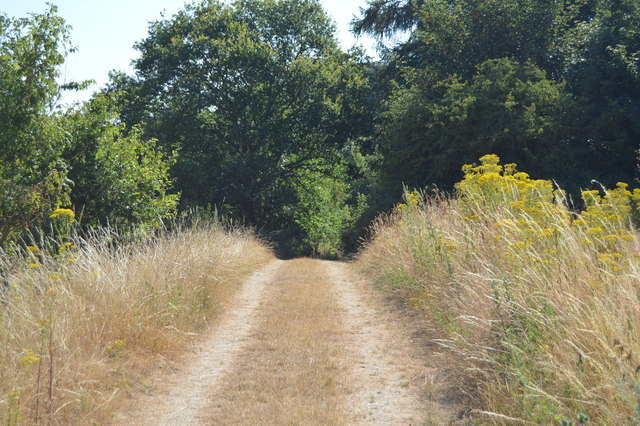
SU7783 : The Chiltern Way
taken 6 years ago, near to Aston, Wokingham, England
This is 1 of 3 images, with title The Chiltern Way in this square
The Chiltern Way
Created by the Chiltern Society as its Millennium Project, the Way originally took in all of the Chilterns from north to south across the Chilterns Area of Outstanding Natural Beauty, in a 125-miles circuit extending from Ewelme in the south west, Chorleywood in the south east and Sharpenhoe Clappers and Great Offley in the north east. It was based on an earlier unofficial route, the Chiltern Hundred.
The Way passes through some of the most attractive parts of the Chilterns, including the Bovingdon Plateau, the Chess valley, the Misbourne valley, Penn Country, the Hambleden valley, Stonor Park, Ewelme, Swyncombe Down, Bledlow Ridge, Hampden Country, Bulbourne valley and Dunstable Down.
The original 200km (125 miles) Way took in Hemel via Chalfont St Giles, the edge of Marlow, Hambleden, Bix Bottom, Ewelme, the Ridgeway, Stokenchurch, Great Hampden, Aldbury, the Dunstable Downs, Sharpenhoe Clappers and Harpenden.
Two extensions have been added in 2003: the southern adds a loop of 50km (35 miles) from Bix Bottom via Mapledurham on the Thames and the northern extension 44km (27 miles) from Sharpenhoe Clappers via the Icknield Way and the outskirts of Hitchin. A short cut from Bix Bottom creates a 16km (10 miles) loop via Ewelme.
Although officially starting at Hemel Hempstead Station, the walk can be started at many other places on the route. The Way also has links with other routes including Chiltern Heritage Trail, Ridgeway National Trail, Icknield Way Path, Oxfordshire, Swan's and South Bucks Ways and Grand Union Canal, Lea Valley and Chess Valley Walks.
See other images of The Chiltern Way
 Map © Crown Copyright")
TIP: Click the map for more Large scale mapping
- Grid Square
- SU7783, 30 images (more nearby 🔍)
- Photographer
- N Chadwick (more nearby)
- Date Taken
- Sunday, 15 July, 2018 (more nearby)
- Submitted
- Sunday, 21 October, 2018
- Subject Location
-
OSGB36:
 SU 7796 8397 [10m precision]
WGS84: 51:32.9547N 0:52.6237W - Camera Location
-
OSGB36: SU 7795 8397
- View Direction
- East-southeast (about 112 degrees)