2018
NT9711 : Footpath to Castle Hill
taken 6 years ago, near to Alnham, Northumberland, England
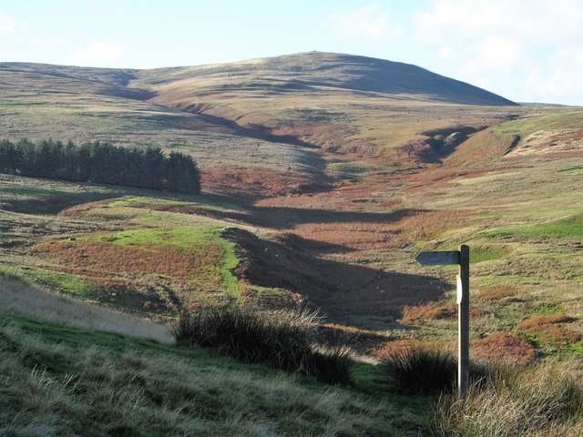
Footpath to Castle Hill
The signpost points the way to Castle Hill, but the view is in the opposite direction along the line of the Spartley Burn towards the distant cairn on the summit of Hogdon Law.
 Map © Crown Copyright")
TIP: Click the map for more Large scale mapping
- Grid Square
- NT9711, 11 images (more nearby 🔍)
- Photographer
- Gordon Hatton (more nearby)
- Date Taken
- Sunday, 14 October, 2018 (more nearby)
- Submitted
- Wednesday, 24 October, 2018
- Subject Location
-
OSGB36:
 NT 9780 1123 [10m precision]
WGS84: 55:23.7010N 2:2.1770W - Camera Location
-
OSGB36: NT 9787 1121
- View Direction
- West-northwest (about 292 degrees)