2018
SX4772 : Derelict farm building, Crowndale
taken 5 years ago, near to Walreddon, Devon, England
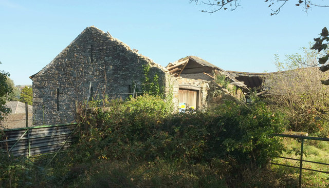
Derelict farm building, Crowndale
The building whose end gable wall is seen on the right of SX4772 : Crowndale Farm is shown to be roofless. It seems likely that the wall is the one described as having "three lower and one upper ventilation slits", in which case the "crown post roof" is presumably lost.
 Map © Crown Copyright")
TIP: Click the map for more Large scale mapping
- Grid Square
- SX4772, 34 images (more nearby 🔍)
- Photographer
- Derek Harper (more nearby)
- Date Taken
- Saturday, 20 October, 2018 (more nearby)
- Submitted
- Friday, 26 October, 2018
- Subject Location
-
OSGB36:
 SX 4729 7263 [10m precision]
WGS84: 50:32.0076N 4:9.3692W - Camera Location
-
OSGB36: SX 4726 7263
- View Direction
- EAST (about 90 degrees)