2018
NN7788 : Erosion on Allt Coire nan Dearcag above Glen Tromie
taken 5 years ago, near to Allt Coire Nan Dearcag [water Feature], Highland, Great Britain
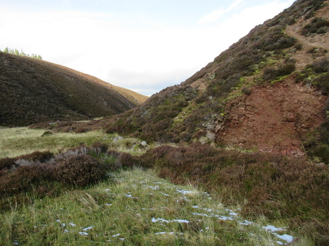
Erosion on Allt Coire nan Dearcag above Glen Tromie
The erosion here gets down to sedimentary bedrock rather than just biting through sand and gravel.
 Map © Crown Copyright")
TIP: Click the map for more Large scale mapping
- Grid Square
- NN7788, 8 images (more nearby 🔍)
- Photographer
- ian shiell (more nearby)
- Date Taken
- Wednesday, 31 October, 2018 (more nearby)
- Submitted
- Wednesday, 31 October, 2018
- Subject Location
-
OSGB36:
 NN 7753 8836 [10m precision]
WGS84: 56:58.2108N 4:0.9697W - Camera Location
-
OSGB36: NN 7754 8831
- View Direction
- NORTH (about 0 degrees)