2018
NZ3756 : Bancroft Terrace, Sunderland
taken 5 years ago, near to South Hylton, Sunderland, England
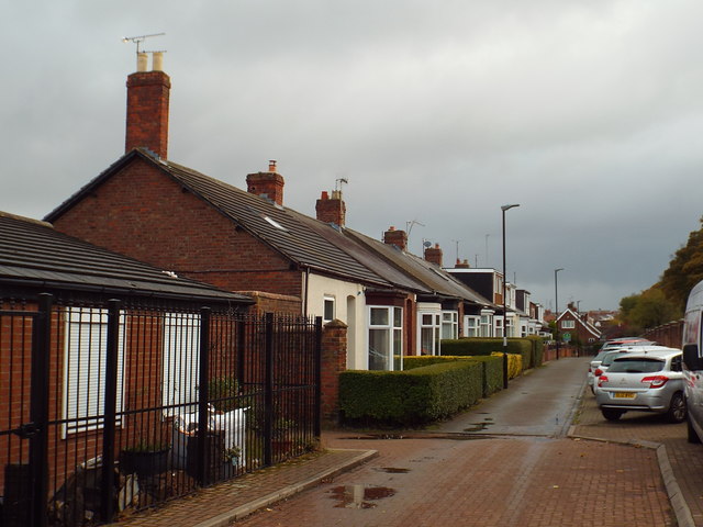
Bancroft Terrace, Sunderland
Bancroft Terrace is flanked on one side by a row of Sunderland cottages.
Sunderland cottages
Sunderland expanded rapidly during the Victorian era, as it became a centre for coal-mining and shipbuilding. To provide housing for workers, streets of terraced bungalows were built and then sold to skilled workers who could afford to buy them. This was a different approach to many other towns and cities, hence this type of housing is called "Sunderland cottages".
Further information can be found on the Sunderland Heritage website: Link
 Map © Crown Copyright")
TIP: Click the map for more Large scale mapping
- Grid Square
- NZ3756, 47 images (more nearby 🔍)
- Photographer
- Malc McDonald (more nearby)
- Date Taken
- Saturday, 27 October, 2018 (more nearby)
- Submitted
- Thursday, 1 November, 2018
- Subject Location
-
OSGB36:
 NZ 3750 5663 [10m precision]
WGS84: 54:54.1795N 1:25.0036W - Camera Location
-
OSGB36: NZ 3749 5664
- View Direction
- Southeast (about 135 degrees)