2018
NJ1624 : Tom a' Chor from Cairn Daimh
taken 5 years ago, 4 km WNW of Auchnarrow, Moray, Scotland
Tom a' Chor from Cairn Daimh
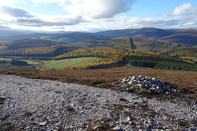
The map shows the Tomintoul Spur of the Speyside Way following a track that curves left of the fence to where the slope of the hill steepens, and there is a fine view to Tom a' Chor, with mixed larch and evergreen conifers covering most of it, and the Hills of Cromdale on the skyline. To the left is Carn Meilich, also forested, and in the distance the Cairngorms. The official Speyside Way web site is at Link - beware an unofficial site with a similar URL ending in .org.
Speyside Way
The Speyside Way is a long-distance path linking Buckie on the Moray Coast to Aviemore in Strathspey.
The official Speyside Way web site at Link
Beware a similar-sounding unofficial web site ending in .org that contains inaccurate information but tends to come up in search engines well ahead of the official one!
 Map © Crown Copyright")
TIP: Click the map for more Large scale mapping
- Grid Square
- NJ1624, 9 images (more nearby 🔍)
- Photographer
- Anne Burgess (more nearby)
- Date Taken
- Thursday, 8 November, 2018 (more nearby)
- Submitted
- Saturday, 10 November, 2018
- Subject Location
-
OSGB36:
 NJ 168 245 [100m precision]
WGS84: 57:18.2146N 3:22.8813W - Camera Location
-
OSGB36: NJ 180 250
- View Direction
- West-southwest (about 247 degrees)