2018
NJ1826 : Tomintoul Spur of the Speyside Way
taken 5 years ago, 3 km from Tomnavoulin, Moray, Scotland
Tomintoul Spur of the Speyside Way
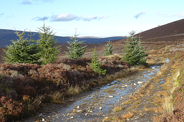
The path here follows the contour round the shoulder of Carn Liath. It was firmer going than the path beside the forest, but it was quite wet. The official Speyside Way web site is at Link - beware an unofficial site with a similar URL ending in .org.
Speyside Way
The Speyside Way is a long-distance path linking Buckie on the Moray Coast to Aviemore in Strathspey.
The official Speyside Way web site at Link
Beware a similar-sounding unofficial web site ending in .org that contains inaccurate information but tends to come up in search engines well ahead of the official one!
 Map © Crown Copyright")
TIP: Click the map for more Large scale mapping
- Grid Square
- NJ1826, 11 images (more nearby 🔍)
- Photographer
- Anne Burgess (more nearby)
- Date Taken
- Thursday, 8 November, 2018 (more nearby)
- Submitted
- Saturday, 10 November, 2018
- Subject Location
-
OSGB36:
 NJ 1816 2627 [10m precision]
WGS84: 57:19.1769N 3:21.6321W - Camera Location
-
OSGB36: NJ 1817 2620
- View Direction
- NORTH (about 0 degrees)