2018
SK3577 : Benchmark on gatepost at entrance to #62 Hallowes Lane
taken 5 years ago, near to Dronfield, Derbyshire, England
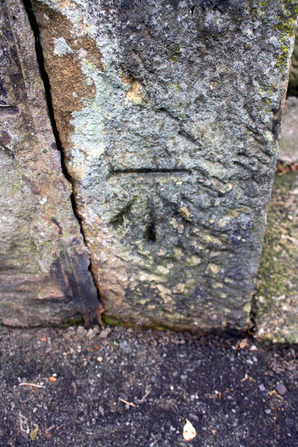
Benchmark on gatepost at entrance to #62 Hallowes Lane
Ordnance Survey cut mark benchmark levelled at 151.751m above Newlyn Datum
 Map © Crown Copyright")
TIP: Click the map for more Large scale mapping
- Grid Square
- SK3577, 44 images (more nearby 🔍)
- Photographer
- Roger Templeman (more nearby)
- Date Taken
- Tuesday, 6 November, 2018 (more nearby)
- Submitted
- Saturday, 17 November, 2018
- Subject Location
-
OSGB36:
 SK 3564 7786 [10m precision]
WGS84: 53:17.7903N 1:28.0043W - Camera Location
-
OSGB36: SK 3564 7786
- View Direction
- WEST (about 270 degrees)