2018
TF3176 : Earthworks at Oxcombe: aerial 2018
taken 5 years ago, near to Oxcombe, Lincolnshire, England
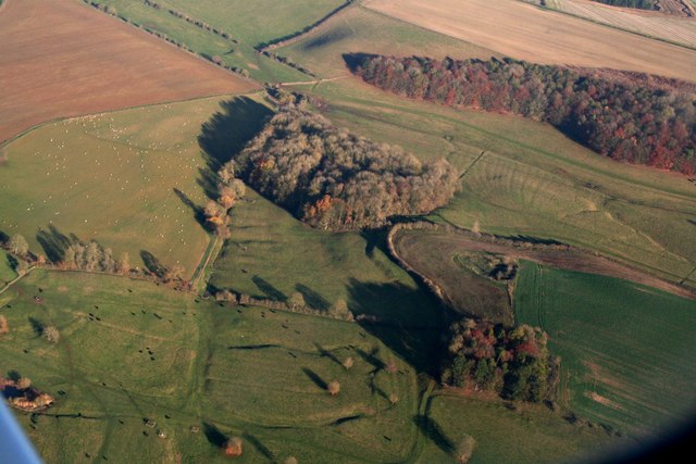
Earthworks at Oxcombe: aerial 2018
 Map © Crown Copyright")
TIP: Click the map for more Large scale mapping
- Grid Square
- TF3176, 44 images (more nearby 🔍)
- Photographer
- Chris (more nearby)
- Date Taken
- Sunday, 18 November, 2018 (more nearby)
- Submitted
- Tuesday, 20 November, 2018
- Subject Location
-
OSGB36:
 TF 3128 7686 [10m precision]
WGS84: 53:16.3490N 0:1.9687W - Camera Location
-
OSGB36: TF 3035 7636
- View Direction
- East-northeast (about 67 degrees)