2018
NT2060 : Silverburn and the Silver Burn
taken 5 years ago, near to Silverburn, Midlothian, Scotland
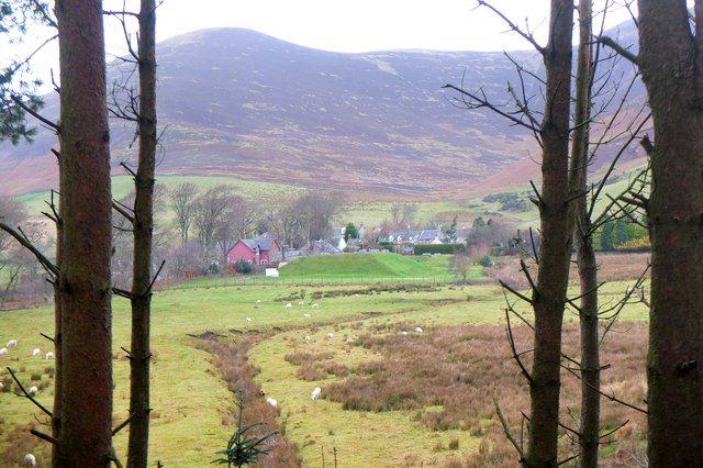
Silverburn and the Silver Burn
The village seen from the woodland path from Lowrie's Den with the burn crossing the field in the foreground before entering the wood en route to joining the River North Esk.
 Map © Crown Copyright")
TIP: Click the map for more Large scale mapping
- Grid Square
- NT2060, 39 images (more nearby 🔍)
- Photographer
- Jim Barton (more nearby)
- Date Taken
- Friday, 30 November, 2018 (more nearby)
- Submitted
- Saturday, 1 December, 2018
- Subject Location
-
OSGB36:
 NT 2039 6022 [10m precision]
WGS84: 55:49.7176N 3:16.3448W - Camera Location
-
OSGB36: NT 2082 6010
- View Direction
- West-northwest (about 292 degrees)