2018
SK4451 : Remains of bridge over the Cromford Canal
taken 5 years ago, near to Ironville, Derbyshire, England
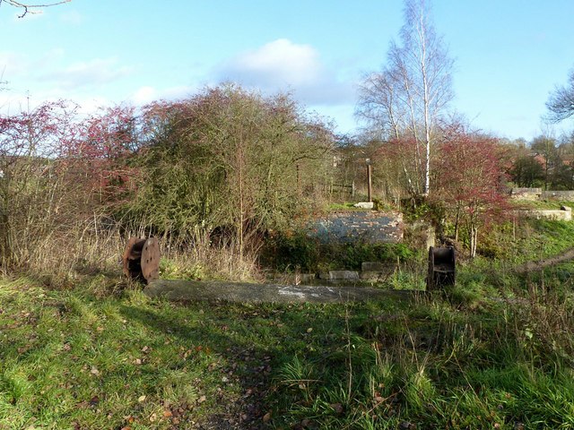
Remains of bridge over the Cromford Canal
This provided a connection from the Codnorpark works into Jacksdale. The odd bits of remaining ironwork suggest that it might have had a moveable deck. Originally it carried a tramroad linking to early coal mines on the Nottinghamshire side of the Erewash valley.
Cromford Canal
The Cromford Canal ran 14.5 miles from Langley Mill (where there was a connection to the Erewash and Nottingham Canals) to Cromford on the edge of the Peak District. It was opened in 1794 and for many years traded profitably carrying mainly coal, limestone, iron ore and lead. As with many other canals, however, it suffered from railway competition and was dealt a major blow when Butterley Tunnel had to be closed permanently in 1900 due to subsidence. The southern stretch remained open until 1944 when it was formally abandoned (except for a short distance at Langley Mill). Today there is an active restoration society, the Friends of the Cromford Canal, that hopes eventually to reopen the canal for navigation.
 Map © Crown Copyright")
TIP: Click the map for more Large scale mapping
- Grid Square
- SK4451, 63 images (more nearby 🔍)
- Photographer
- Alan Murray-Rust (more nearby)
- Date Taken
- Friday, 30 November, 2018 (more nearby)
- Submitted
- Monday, 3 December, 2018
- Subject Location
-
OSGB36:
 SK 4438 5134 [10m precision]
WGS84: 53:3.4486N 1:20.3573W - Camera Location
-
OSGB36: SK 4436 5133
- View Direction
- East-northeast (about 67 degrees)