2013
SK5082 : Chesterfield Canal Feeder at Kiveton Park Station
taken 11 years ago, near to Kiveton Park, Rotherham, England
This is 1 of 3 images, with title Chesterfield Canal Feeder at Kiveton Park Station in this square
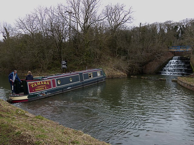
Chesterfield Canal Feeder at Kiveton Park Station
Nb "Tamara 2 reaches the Manor Road winding hole at Kiveton Park Station (the current head of navigation) where the feeder from Harthill Reservoir runs into the Chesterfield Canal. Winding holes such as this are provided at strategic points along the canal for turning boats, which are generally longer than the canal is wide. Here, Tamara 2 demonstrates how these winding holes are used. Canal arms and junctions can also be used to similar effect.
 Map © Crown Copyright")
TIP: Click the map for more Large scale mapping
- Grid Square
- SK5082, 82 images (more nearby 🔍)
- Photographer
- Mike Nield (more nearby)
- Date Taken
- Saturday, 13 April, 2013 (more nearby)
- Submitted
- Tuesday, 4 December, 2018
- Subject Location
-
OSGB36:
 SK 5051 8237 [10m precision]
WGS84: 53:20.1500N 1:14.5763W - Camera Location
-
OSGB36: SK 5054 8236
- View Direction
- West-northwest (about 292 degrees)