2018
SK5704 : Benchmark on building at junction of Nugent Street and Tudor Road
taken 6 years ago, near to Leicester, England
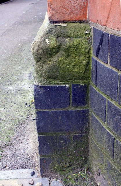
Benchmark on building at junction of Nugent Street and Tudor Road
Ordnance Survey cut mark benchmark described on the Bench Mark Database at Link
 Map © Crown Copyright")
TIP: Click the map for more Large scale mapping
- Grid Square
- SK5704, 237 images (more nearby 🔍)
- Photographer
- Roger Templeman (more nearby)
- Date Taken
- Friday, 11 May, 2018 (more nearby)
- Submitted
- Thursday, 6 December, 2018
- Subject Location
-
OSGB36:
 SK 5770 0486 [10m precision]
WGS84: 52:38.3056N 1:8.9268W - Camera Location
-
OSGB36: SK 5770 0486
- View Direction
- South-southeast (about 157 degrees)