SK4924 : River Soar south-west of Sutton Bonington in Nottinghamshire
taken 11 years ago, near to Sutton Bonington, Nottinghamshire, England
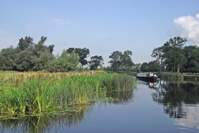
The River Soar is a tributary of the River Trent and is the principal river of Leicestershire. The source of the river is midway between Hinckley and Lutterworth. The river then flows north through Leicester, where it is joined by the Grand Union Canal. Continuing on through the Leicestershire Soar Valley, it passes Loughborough and Kegworth until it reaches the River Trent south of Long Eaton. Length: 59 miles (95km).
The Loughborough Navigation (including the River Soar) was bought by the Grand Union Canal Carrying Company in 1932.
24.1 miles (38.8km) long with 18 locks from just above Freeman's Meadow Lock in Leicester to the River Trent and Erewash Canal; the River Soar forms part of the Grand Union Canal Leicester Section. Thomas Skipworth was granted permission by Charles I to make the river navigable in 1634 but the scheme was never completed. The section between the River Trent and Loughborough was made navigable in 1778 by engineers John Smith and John May and extended by William Jessop to Leicester in 1794. The Grand Union Canal (not to be confused with the later canal route of the same name) connected it south to the southern canals network and to London in 1814. It was not until 1894 that the Grand Union and the Leicestershire & Northamptonshire Union Canals were purchased by the Grand Junction Canal Company that later formed the Grand Union Canal who purchased the Leicester and Loughborough Navigations in 1932 along with the Erewash Canal.
 Map © Crown Copyright")
- Grid Square
- SK4924, 72 images (more nearby 🔍)
- Photographer
- Roger D Kidd (more nearby)
- Date Taken
- Tuesday, 27 August, 2013 (more nearby)
- Submitted
- Saturday, 8 December, 2018
- Subject Location
-
OSGB36:
 SK 4995 2493 [10m precision]
WGS84: 52:49.1760N 1:15.6149W - Camera Location
-
OSGB36: SK 4995 2482
- View Direction
- NORTH (about 0 degrees)