2018
NY9435 : Horizontal rock surfaces at Snowhope Carrs
taken 5 years ago, 4 km SSW of Eastgate, County Durham, England
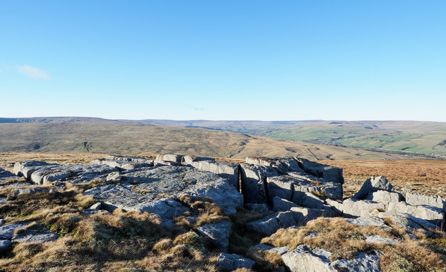
Horizontal rock surfaces at Snowhope Carrs
Snowhope Carrs is one of a number of rock exposures in the vicinity of Snowhope Moor. It, and the others are low outcropping bands of broken rock, mainly tumbled into angular boulders. Black Hill and Chapel Fell lie beyond at the left side of the image; Weardale is the valley to the right.
 Map © Crown Copyright")
TIP: Click the map for more Large scale mapping
- Grid Square
- NY9435, 27 images (more nearby 🔍)
- Photographer
- Trevor Littlewood (more nearby)
- Date Taken
- Monday, 24 December, 2018 (more nearby)
- Submitted
- Tuesday, 25 December, 2018
- Subject Location
-
OSGB36:
 NY 9447 3523 [10m precision]
WGS84: 54:42.7229N 2:5.2412W - Camera Location
-
OSGB36: NY 9449 3520
- View Direction
- North-northwest (about 337 degrees)