2007
TM3845 : Simpsons Saltings
taken 16 years ago, near to Boyton, Suffolk, England
This is 1 of 2 images, with title Simpsons Saltings in this square
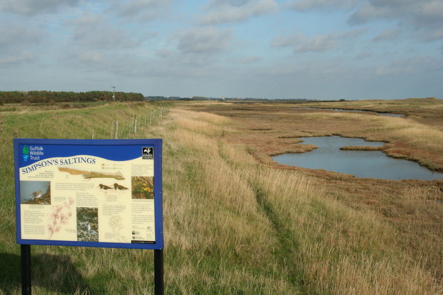
Simpsons Saltings
37 Acres of coastal saltings with a wealth of uncommon coastal and saltmarsh plants. The Suffolk Coastal Path runs along the sea wall to the left.
 Map © Crown Copyright")
TIP: Click the map for more Large scale mapping
- Grid Square
- TM3845, 15 images (more nearby 🔍)
- Photographer
- John Lemay (more nearby)
- Date Taken
- Thursday, 1 November, 2007 (more nearby)
- Submitted
- Thursday, 1 November, 2007
- Subject Location
-
OSGB36:
 TM 380 451 [100m precision]
WGS84: 52:3.2299N 1:28.2525E - Camera Location
-
OSGB36: TM 380 451
- View Direction
- Northeast (about 45 degrees)