2019
SE2755 : Queen Ethelburga's Park
taken 5 years ago, 3 km from Beckwithshaw, North Yorkshire, England
This is 1 of 2 images, with title Queen Ethelburga's Park in this square
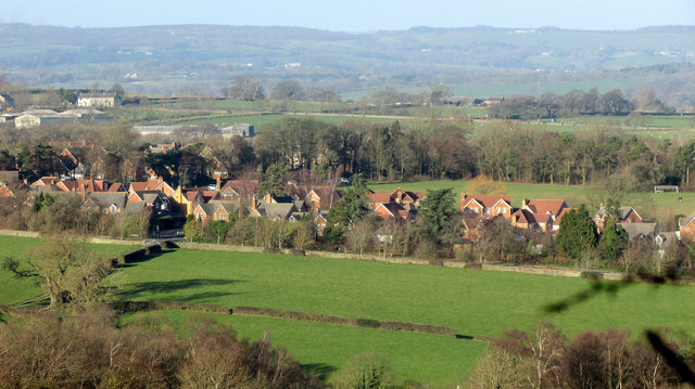
Queen Ethelburga's Park
Housing off Pennypot Lane seen from the same spot as SE2755 : New housing west of Harrogate and SE2655 : Uniacke Barracks. This was built on the original site of Queen Ethelburgas School, which moved to a new site in 1991. Away to the left are farm buildings and houses on Saltergate Hill.
 Map © Crown Copyright")
TIP: Click the map for more Large scale mapping
- Grid Square
- SE2755, 22 images (more nearby 🔍)
- Photographer
- Derek Harper (more nearby)
- Date Taken
- Tuesday, 1 January, 2019 (more nearby)
- Submitted
- Monday, 7 January, 2019
- Subject Location
-
OSGB36:
 SE 278 555 [100m precision]
WGS84: 53:59.6877N 1:34.6468W - Camera Location
-
OSGB36: SE 2856 5447
- View Direction
- North-northwest (about 337 degrees)