2019
NZ0536 : Barn beside Holebeck Gill
taken 5 years ago, near to Wolsingham, County Durham, England
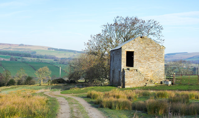
Barn beside Holebeck Gill
The farm road rises from the farm, Holebeck House; Holebeck Gill lies out of view to the left. The building is assumed to be a barn, (disused), but an acquaintance tells that once it had fireplaces within - (they've been removed) - so perhaps it was once a dwelling or dwellings.
 Map © Crown Copyright")
TIP: Click the map for more Large scale mapping
- Grid Square
- NZ0536, 42 images (more nearby 🔍)
- Photographer
- Trevor Littlewood (more nearby)
- Date Taken
- Friday, 18 January, 2019 (more nearby)
- Submitted
- Saturday, 19 January, 2019
- Subject Location
-
OSGB36:
 NZ 0560 3612 [10m precision]
WGS84: 54:43.2029N 1:54.8751W - Camera Location
-
OSGB36: NZ 0559 3606
- View Direction
- NORTH (about 0 degrees)