2019
NZ8809 : The old corn mill, Ruswarp - weir
taken 5 years ago, near to Ruswarp, North Yorkshire, England
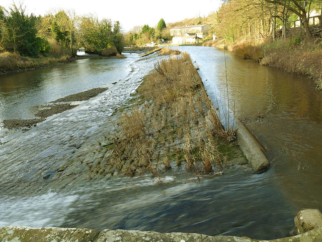
The old corn mill, Ruswarp - weir
At around 225 metres, this must be one of the longest river weirs I have seen. But the Esk is known to be liable to flood, so the weir needed to be capable of discharging high flows without drowning out the mill downstream. It marks the tidal limit of the river, and a turbine was installed in 2012 to capture some of the energy of the river's flow. See NZ8809 : The old corn mill, The Carrs, Ruswarp for the mill itself and a bit of history.
River Esk (North Yorkshire)
River Esk rises on Westerdale Moor (North Yorkshire Moors) and flows east 28 miles to Whitby. A good Salmon river.
 Map © Crown Copyright")
TIP: Click the map for more Large scale mapping
- Grid Square
- NZ8809, 146 images (more nearby 🔍)
- Photographer
- Stephen Craven (more nearby)
- Date Taken
- Sunday, 13 January, 2019 (more nearby)
- Submitted
- Tuesday, 22 January, 2019
- Subject Location
-
OSGB36:
 NZ 8874 0905 [10m precision]
WGS84: 54:28.1443N 0:37.9370W - Camera Location
-
OSGB36: NZ 8880 0908
- View Direction
- West-southwest (about 247 degrees)