TQ0088 : Tunnel entrance, Gerrards Cross Station
taken 5 years ago, near to Gerrards Cross, Buckinghamshire, England
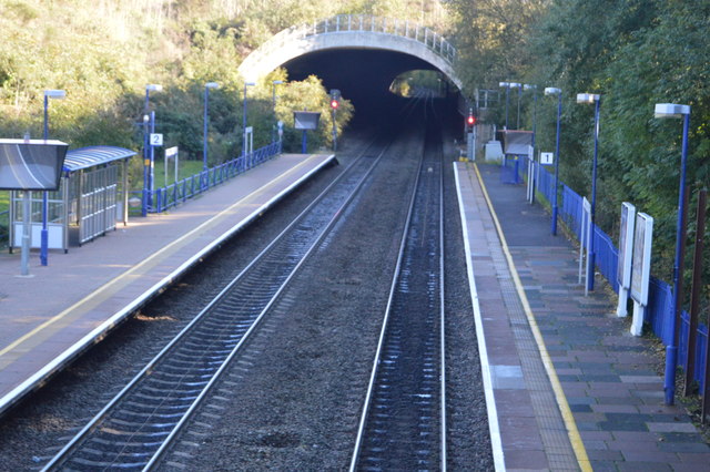
Gerrards Cross station is in the village of Gerrards Cross in Buckinghamshire. It is on the Chiltern Main Line between Denham Golf Club and Seer Green and Jordans. The station opened in 1906.
Wikipedia: Link
The Chiltern Main Line is an inter-urban, regional and commuter railway, part of the British railway system. It links London and Birmingham, England's two largest cities, by a 112-mile route via High Wycombe, Banbury, and Leamington Spa. It complements the West Coast Main Line, the main InterCity route between London and Birmingham. The name Chiltern Line was invented as a marketing name for the line by Network SouthEast in 1985, in reference to the Chiltern Hills.
The line forms part of the suburban rail networks in both cities. The majority of towns towards the London end of the route are prosperous suburbs or commuter-belt towns, such as Ruislip, Gerrards Cross and Beaconsfield. These have a journey time of 30 minutes or less to London Marylebone. In the West Midlands it is one of the Snow Hill Lines. Commuter trains operated by London Midland run between Birmingham Snow Hill, Solihull and Leamington Spa.
Wikipedia: Link
 Map © Crown Copyright")
- Grid Square
- TQ0088, 80 images (more nearby 🔍)
- Photographer
- N Chadwick (more nearby)
- Date Taken
- Sunday, 21 October, 2018 (more nearby)
- Submitted
- Thursday, 7 February, 2019
- Subject Location
-
OSGB36:
 TQ 0028 8871 [10m precision]
WGS84: 51:35.2998N 0:33.2347W - Camera Location
-
OSGB36: TQ 0019 8877
- View Direction
- Southeast (about 135 degrees)