2019
NT9952 : A path from Riverdene Rd to Yarrow Slake
taken 5 years ago, near to Tweedmouth, Northumberland, England
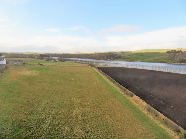
A path from Riverdene Rd to Yarrow Slake
From where it passes below the East Coast Main Railway Line, and follows a boundary between two fields. To its right the ploughed field extends to Hang-a-Dyke Neuk (River Tweed), and to its left is Mill Farm with a Wind Turbine (close by to its right).
 Map © Crown Copyright")
TIP: Click the map for more Large scale mapping
- Grid Square
- NT9952, 1400 images (more nearby 🔍)
- Photographer
- Stanley Howe (more nearby)
- Date Taken
- Wednesday, 6 February, 2019 (more nearby)
- Submitted
- Saturday, 9 February, 2019
- Subject Location
-
OSGB36:
 NT 9900 5294 [10m precision]
WGS84: 55:46.1879N 2:1.0504W - Camera Location
-
OSGB36: NT 9908 5292
- View Direction
- West-northwest (about 292 degrees)