2019
TQ2404 : Shoreham Power Station
taken 5 years ago, near to Southwick, West Sussex, England
This is 1 of 22 images, with title Shoreham Power Station in this square
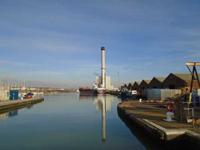
Shoreham Power Station
Viewed from the Lock
Shoreham Power Station
Shoreham Power Station is a 400MWe gas-fired power in Southwick, West Sussex. It was built on the site of the Brighton A & B Power Stations. It was opened in 2002 costing £150m Link
River Adur
The river was formerly navigable for large vessels up as far as Steyning, where there was a large port, but over time the river valley became silted up and the port moved down to the deeper waters nearer the mouth in Shoreham-by-Sea. Link
 Map © Crown Copyright")
TIP: Click the map for more Large scale mapping
- Grid Square
- TQ2404, 209 images (more nearby 🔍)
- Photographer
- Paul Gillett (more nearby)
- Date Taken
- Wednesday, 13 February, 2019 (more nearby)
- Submitted
- Wednesday, 13 February, 2019
- Subject Location
-
OSGB36:
 TQ 24646 04763 [1m precision]
WGS84: 50:49.7396N 0:13.8905W - Camera Location
-
OSGB36: TQ 24299 04785
- View Direction
- EAST (about 90 degrees)