TA0928 : Hull Railway Station
taken 5 years ago, near to Kingston Upon Hull, England
The Yorkshire Coast Line is a railway line. It runs northwards from Hull Paragon to Bridlington and Scarborough calling at other intermediate stations. The line dates from 1846.
Wikipedia: Link
Hull Paragon Interchange is an integrated rail and bus station in the city centre of Kingston upon Hull (commonly called Hull).
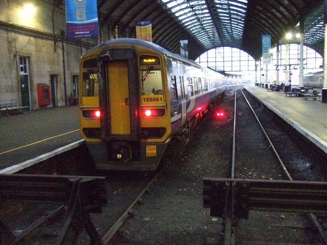
The G.T. Andrews designed Paragon Station and the adjoining Station Hotel opened in 1848 as the new Hull terminus for the growing traffic of the York and North Midland (Y&NMR) leased Hull and Selby Railway (H&S). As well as trains to the west the station was the terminus of the Y&NMR and H&S railway's Hull to Scarborough Line. From the 1860s the station also became the terminus of the Hull & Holderness and Hull & Hornsea railways.
At the beginning of the 20th century the North Eastern Railway (NER) expanded the trainshed and station to the designs of William Bell, installing the present five-arched span platform roof.
A bus station was erected adjacent to the north of the station in the mid 1930s. In the early 2000s plans for an integrated bus and rail station were made. The new station, named "Paragon Interchange" opened in September 2007, integrating the city's railway and bus stations under William Bell's 1900s trainshed.
The station building is Grade II* listed. Link
Wikipedia: Link
 Map © Crown Copyright")
- Grid Square
- TA0928, 6574 images (more nearby 🔍)
- Photographer
- JThomas (more nearby)
- Date Taken
- Saturday, 16 February, 2019 (more nearby)
- Submitted
- Wednesday, 20 February, 2019
- Subject Location
-
OSGB36:
 TA 09177 28770 [1m precision]
WGS84: 53:44.6330N 0:20.7624W - Camera Location
-
OSGB36: TA 0918 2877
- View Direction
- WEST (about 270 degrees)