2019
NO2011 : Ruined farmstead of Wester Pitlour
taken 5 years ago, near to Strathmiglo, Fife, Scotland
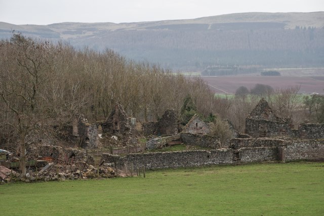
Ruined farmstead of Wester Pitlour
A farmstead, which comprises four roofed buildings ranged around a courtyard, is depicted on the 1st edition of the OS 6-inch map (Fife and Kinross 1856, sheet 16). A horse-engine house is attached to the building on the SW side of the farm. Only one building, on the SE side of the courtyard, is shown, roofed, on the current edition of the OS 1:10000 map (1974); the remainder are unroofed.
Information from RCAHMS (PM) 22 November 1996 (Link
Information from RCAHMS (PM) 22 November 1996 (Link
 Map © Crown Copyright")
TIP: Click the map for more Large scale mapping
- Grid Square
- NO2011, 8 images (more nearby 🔍)
- Photographer
- Becky Williamson (more nearby)
- Date Taken
- Friday, 22 February, 2019 (more nearby)
- Submitted
- Monday, 25 February, 2019
- Subject Location
-
OSGB36:
 NO 2067 1127 [10m precision]
WGS84: 56:17.2334N 3:16.9852W - Camera Location
-
OSGB36: NO 20692 11360
- View Direction
- SOUTH (about 180 degrees)