2019
NT2646 : Burnhead Farm, Eddleston
taken 5 years ago, near to Eddleston, Scottish Borders, Scotland
This is 1 of 4 images, with title starting with Burnhead Farm in this square
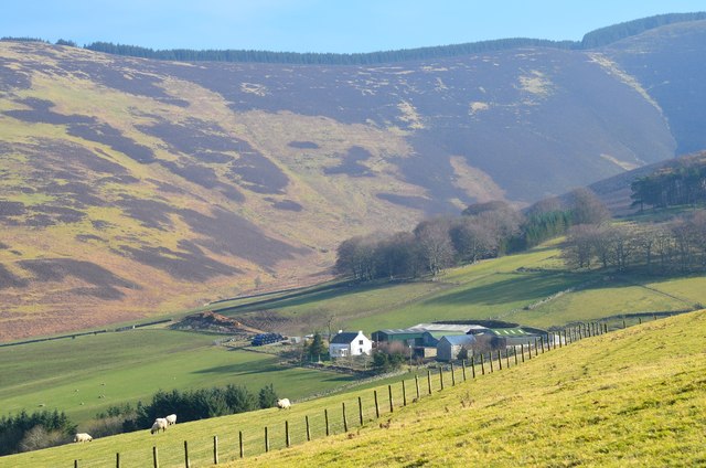
Burnhead Farm, Eddleston
A hill farm on the west side of the ridge between Dundreich and Peebles.
 Map © Crown Copyright")
TIP: Click the map for more Large scale mapping
- Grid Square
- NT2646, 23 images (more nearby 🔍)
- Photographer
- Jim Barton (more nearby)
- Date Taken
- Wednesday, 27 February, 2019 (more nearby)
- Submitted
- Saturday, 2 March, 2019
- Subject Location
-
OSGB36:
 NT 2618 4602 [10m precision]
WGS84: 55:42.1193N 3:10.5697W - Camera Location
-
OSGB36: NT 2559 4603
- View Direction
- EAST (about 90 degrees)