2019
SD9700 : Lock 11W on the Huddersfield Narrow Canal
taken 5 years ago, near to Mossley, Tameside, England
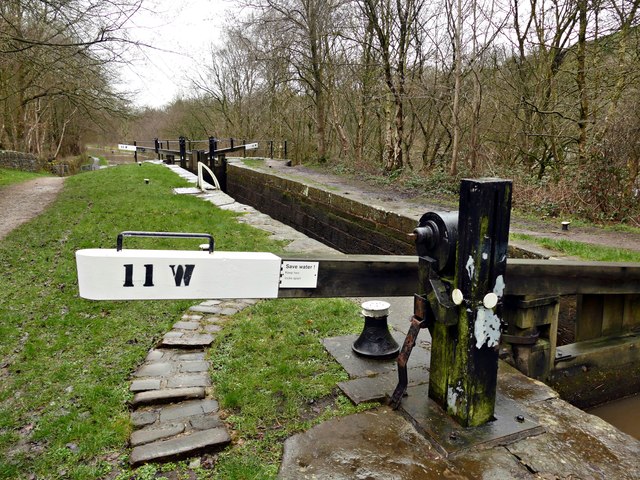
Lock 11W on the Huddersfield Narrow Canal
The locks are numbered incrementally from both ends of the canal, hence the W suffix here. The bridges, however, are numbered sequentially from the Huddersfield end.
Huddersfield Narrow Canal
The Huddersfield Narrow Canal opened in 1811. It runs for just under 20 miles from Lock 1E, where it joins the Huddersfield Broad Canal at the rear of the University of Huddersfield campus, to the junction with the Ashton Canal at Whitelands Basin in Ashton-under-Lyne. It crosses the Pennines by means of 74 locks and the Standedge Tunnel.
 Map © Crown Copyright")
TIP: Click the map for more Large scale mapping
- Grid Square
- SD9700, 48 images (more nearby 🔍)
- Photographer
- Graham Hogg (more nearby)
- Date Taken
- Monday, 18 March, 2019 (more nearby)
- Submitted
- Wednesday, 20 March, 2019
- Subject Location
-
OSGB36:
 SD 9735 0087 [10m precision]
WGS84: 53:30.2709N 2:2.4853W - Camera Location
-
OSGB36: SD 97351 00890
- View Direction
- SOUTH (about 180 degrees)