2019
SE7630 : Drain Lane (track) joins the A614 at Caville Bridge
taken 5 years ago, near to Portington, East Riding of Yorkshire, England
This is 1 of 5 images, with title starting with Drain in this square
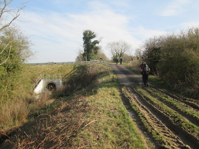
Drain Lane (track) joins the A614 at Caville Bridge
To the left Near Drain enters the pipe under the A614, it is a long and influential drain in this area and eventually discharges into the River Ouse at Skelton just south of Howdendyke
 Map © Crown Copyright")
TIP: Click the map for more Large scale mapping
- Grid Square
- SE7630, 21 images (more nearby 🔍)
- Photographer
- Martin Dawes (more nearby)
- Date Taken
- Wednesday, 20 March, 2019 (more nearby)
- Submitted
- Thursday, 28 March, 2019
- Subject Location
-
OSGB36:
 SE 7682 3018 [10m precision]
WGS84: 53:45.7391N 0:50.1708W - Camera Location
-
OSGB36: SE 7676 3022
- View Direction
- East-southeast (about 112 degrees)