SZ7099 : Hayling Island Station
taken 60 years ago, near to South Hayling, Hampshire, England
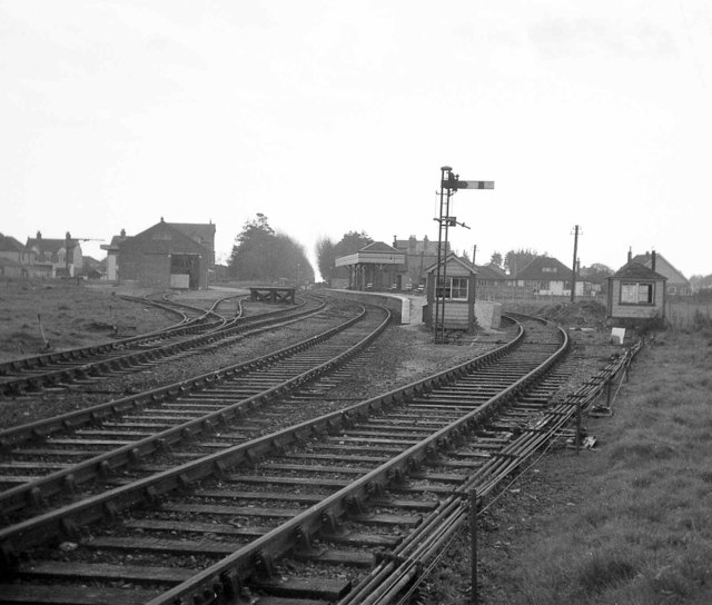
The 4½ mile branch line from Havant to Hayling Island station near the south coast of the island was opened throughout in 1867 by an independent company. Independence didn't last long & the line was taken over by the London & Brighton South Coast Rly in 1872. The line was single with no crossing places although there were intermediate stations at Langston & North Hayling. The only significant engineering feature of the line was the 1100ft Langston timber viaduct which linked the island to the mainland railway system. The viaduct had a central swinging span to permit navigation. Passenger traffic was heavy in summer months but very light the rest of the year which meant closure was inevitable - coming in November 1963. The route of the line now forms part of the Hayling Billy foot & cycle path.
The weight restriction imposed by the viaduct meant that only small steam locomotives could be used, with the result that several 'Terrier' 0-6-0T locos, built in the 1870s, survived into the 1960s much to the benefit of the nascent railway preservation movement. The restrictions imposed by the viaduct & its maintenance costs also contributed to the reasons for the closure of the branch line.
Note: Langstone was habitually named Langston by the railways.
 Map © Crown Copyright")
- Grid Square
- SZ7099, 140 images (more nearby 🔍)
- Photographer
- Martin Tester (more nearby)
- Date Taken
- April 1964 (more nearby)
- Submitted
- Monday, 15 April, 2019
- Subject Location
-
OSGB36:
 SZ 7091 9978 [10m precision]
WGS84: 50:47.5955N 0:59.7179W - Camera Location
-
OSGB36: SZ 7092 9983
- View Direction
- SOUTH (about 180 degrees)