2019
NO4203 : Path, Upper Largo
taken 5 years ago, near to Kirkton of Largo or Upper Largo, Fife, Scotland
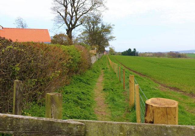
Path, Upper Largo
From where South Feus takes a sharp right turn NO4203 : South Feus, Upper Largo this path heads east out of the village towards the farm buildings at Buckthorns. It connects with another path which heads south to join the Fife Coastal Path at the ruined cottage of Viewforth from where a right turn will take you to Lower Largo and, if you then follow the Serpentine Walk, it will bring you back to South Feus! These paths are all Fife Core Paths.
Information on Fife Core Paths can be found here Link
See Upper Largo article Link
Information on Fife Core Paths can be found here Link
See Upper Largo article Link
 Map © Crown Copyright")
TIP: Click the map for more Large scale mapping
- Grid Square
- NO4203, 196 images (more nearby 🔍)
- Photographer
- Bill Kasman (more nearby)
- Date Taken
- Wednesday, 17 April, 2019 (more nearby)
- Submitted
- Thursday, 18 April, 2019
- Subject Location
-
OSGB36:
 NO 4266 0335 [10m precision]
WGS84: 56:13.1549N 2:55.5722W - Camera Location
-
OSGB36: NO 4260 0336
- View Direction
- East-southeast (about 112 degrees)