2007
SE1226 : The valley of Lumb Brook, Coley
taken 16 years ago, near to Northowram, Calderdale, England
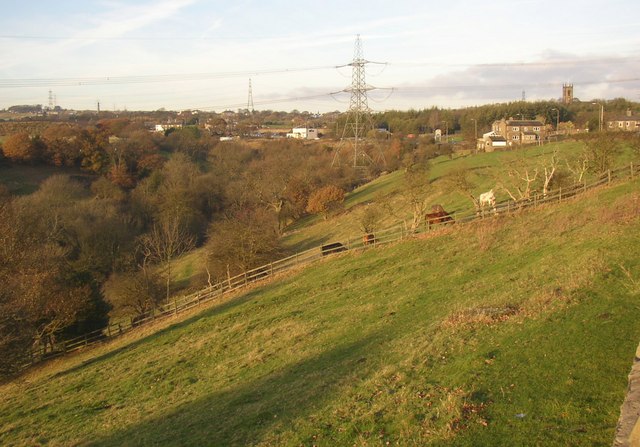
The valley of Lumb Brook, Coley
The Brighouse and Denholme Gate Road runs around the top of the steep slope down into the valley. Coley Church can be seen on the right.
 Map © Crown Copyright")
TIP: Click the map for more Large scale mapping
- Grid Square
- SE1226, 83 images (more nearby 🔍)
- Photographer
- Humphrey Bolton (more nearby)
- Date Taken
- Thursday, 15 November, 2007 (more nearby)
- Submitted
- Thursday, 15 November, 2007
- Subject Location
-
OSGB36:
 SE 122 268 [100m precision]
WGS84: 53:44.2468N 1:48.9916W - Camera Location
-
OSGB36: SE 123 265
- View Direction
- North-northwest (about 337 degrees)