2019
NT1875 : Houses on Brae Park Road Cramond
taken 5 years ago, near to Cramond Bridge, Edinburgh, Scotland
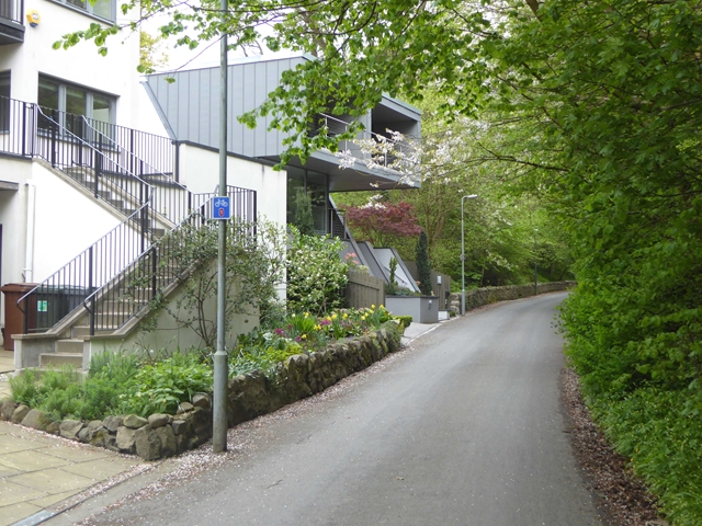
Houses on Brae Park Road Cramond
The road carries both the National Cycle Network route 76 (see sign - Round the Forth route) and the John Muir Way long distance walking and cycle routes.
 Map © Crown Copyright")
TIP: Click the map for more Large scale mapping
- Grid Square
- NT1875, 73 images (more nearby 🔍)
- Photographer
- Oliver Dixon (more nearby)
- Date Taken
- Wednesday, 1 May, 2019 (more nearby)
- Submitted
- Sunday, 5 May, 2019
- Subject Location
-
OSGB36:
 NT 1822 7551 [10m precision]
WGS84: 55:57.9363N 3:18.7003W - Camera Location
-
OSGB36: NT 18196 75500
- View Direction
- East-northeast (about 67 degrees)