2019
NT2546 : Valley of the Longcote Burn
taken 5 years ago, near to Eddleston, Scottish Borders, Scotland
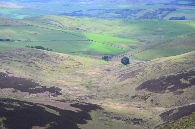
Valley of the Longcote Burn
Moorland and farmland east of Eddleston, seen from the track on Brown Dod.
 Map © Crown Copyright")
TIP: Click the map for more Large scale mapping
- Grid Square
- NT2546, 40 images (more nearby 🔍)
- Photographer
- Jim Barton (more nearby)
- Date Taken
- Sunday, 5 May, 2019 (more nearby)
- Submitted
- Monday, 6 May, 2019
- Subject Location
-
OSGB36:
 NT 2591 4679 [10m precision]
WGS84: 55:42.5318N 3:10.8399W - Camera Location
-
OSGB36: NT 2741 4821
- View Direction
- Southwest (about 225 degrees)