2019
NS9230 : Track by the Roberton Burn
taken 5 years ago, near to Roberton, South Lanarkshire, Scotland
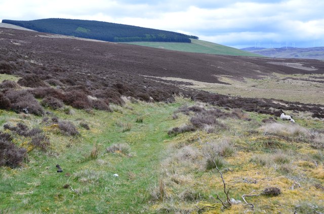
Track by the Roberton Burn
The track follows the valley of the Roberton Burn as it flows SE to join the River Clyde. The plantation is on the southern top of Dungavel Hill above the village of Roberton.
 Map © Crown Copyright")
TIP: Click the map for more Large scale mapping
- Grid Square
- NS9230, 4 images (more nearby 🔍)
- Photographer
- Jim Barton (more nearby)
- Date Taken
- Tuesday, 7 May, 2019 (more nearby)
- Submitted
- Thursday, 9 May, 2019
- Subject Location
-
OSGB36:
 NS 9213 3007 [10m precision]
WGS84: 55:33.1413N 3:42.6880W - Camera Location
-
OSGB36: NS 9206 3011
- View Direction
- East-southeast (about 112 degrees)