2019
NC9218 : Ruins of a Broch below the Forest on Kilearnan Hill
taken 5 years ago, 4 km ESE of Craggie, Highland, Scotland
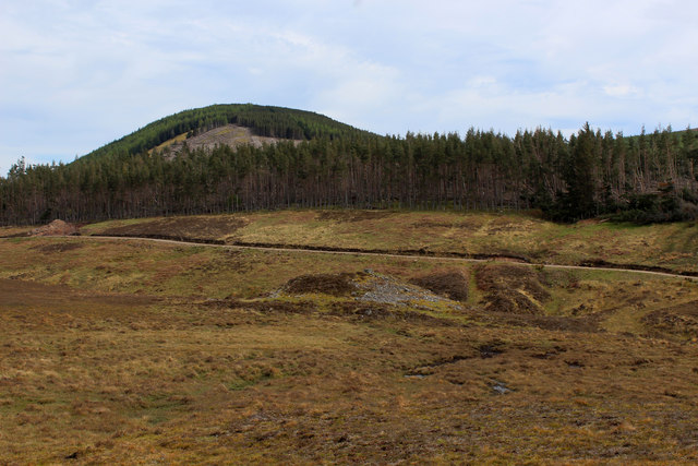
Ruins of a Broch below the Forest on Kilearnan Hill
Reduced to a heap of stones - brochs were Iron Age stone fortified towers, common in Northern Scotland
Brochs
Brochs are a type of iron-age, drystone Pictish House found only in Scotland. They are typically circular in plan and double-walled structures, and are almost exclusive to the far north and the islands.
 Map © Crown Copyright")
TIP: Click the map for more Large scale mapping
- Grid Square
- NC9218, 9 images (more nearby 🔍)
- Photographer
- Chris Heaton (more nearby)
- Date Taken
- Monday, 13 May, 2019 (more nearby)
- Submitted
- Friday, 24 May, 2019
- Subject Location
-
OSGB36:
 NC 9215 1886 [10m precision]
WGS84: 58:8.7269N 3:50.0277W - Camera Location
-
OSGB36: NC 9205 1896
- View Direction
- Southeast (about 135 degrees)