2019
SD4947 : River Wyre, Gubberford Bridge
taken 5 years ago, near to Garstang, Lancashire, England
This is 1 of 3 images, with title starting with River in this square
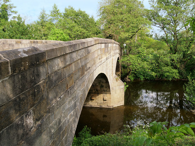
River Wyre, Gubberford Bridge
Early nineteenth century sandstone bridge with two segmented arches, crossing the River Wyre near Cabus. It is a Grade II listed building (Historic England List Entry Number: 1309256 Link ).
).
 Map © Crown Copyright")
TIP: Click the map for more Large scale mapping
- Grid Square
- SD4947, 17 images (more nearby 🔍)
- Photographer
- David Dixon (more nearby)
- Date Taken
- Friday, 24 May, 2019 (more nearby)
- Submitted
- Tuesday, 28 May, 2019
- Subject Location
-
OSGB36:
 SD 495 473 [100m precision]
WGS84: 53:55.1890N 2:46.2151W - Camera Location
-
OSGB36: SD 494 473
- View Direction
- EAST (about 90 degrees)