2019
SJ6603 : Ironbridge B Power Station (Viewed from Dale End Park)
taken 5 years ago, near to Ironbridge, Telford And Wrekin, England
This is 1 of 5 images, with title Ironbridge B Power Station (Viewed from Dale End Park) in this square
Ironbridge B Power Station (Viewed from Dale End Park)
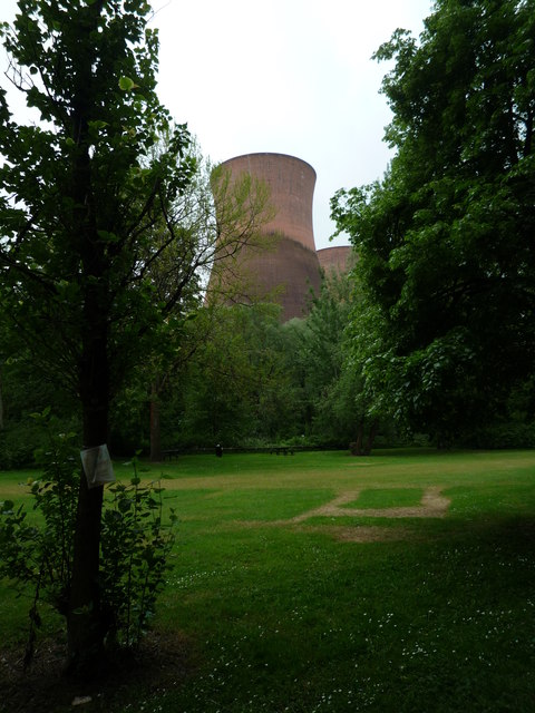
One of the two power stations at Ironbridge, this is the last of the two and this was built from 1963 to 1967, which electricity was generated here in the latter year. The power station started to give power to the National Grid in 11th June 1969, and this lasted until 20th November 2015. This was built by Alan Clark and Kenneth Booth, which the two built these structures very carefully so that these could not be seen from the famous Iron Bridge. The cooling towers were built out of concrete, with a red pigment added so that this could blend in with the surrounding soil. The entire power station will be demolished from 2019 to 2021, meaning one section of Ironbridge's modern industrial history is lost.
 Map © Crown Copyright")
TIP: Click the map for more Large scale mapping
- Grid Square
- SJ6603, 292 images (more nearby 🔍)
- Photographer
- Fabian Musto (more nearby)
- Date Taken
- Thursday, 30 May, 2019 (more nearby)
- Submitted
- Monday, 3 June, 2019
- Subject Location
-
OSGB36:
 SJ 6622 0373 [10m precision]
WGS84: 52:37.8160N 2:30.0311W - Camera Location
-
OSGB36: SJ 6622 0373
- View Direction
- Southwest (about 225 degrees)