SK4726 : The entrance to East Midlands Gateway
taken 5 years ago, near to Kegworth, Leicestershire, England
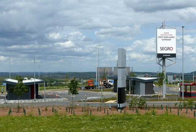
This is an extensive development for large scale distribution warehousing. It covers around 700 acres with 6 million sq. ft. of warehouse space together with a 50 acre rail container terminal with a connection to the Castle Donington freight line. The latter is capable of handling up to 16 full length container trains a day.
When completed there will be 11 large warehouses ranging in size from a 'mere' 225,000 sq. ft. to an enormous 750,000 sq. ft.
It is in a key Midlands location close to Nottingham, Leicester and Derby, with excellent communications. It is adjacent to the M1 and A50, the rail connection provides good access to most parts of the UK and East Midlands Airport is a major air freight hub.
The warehousing area has been created on a single level terraced out of a sloping hillside, involving an enormous amount of earthmoving, some of which has been used to create screening mounds. The rail terminal ends in a cutting which is around 30 metres deep.
As part of the development there was a major reconstruction of the M1 junction 24/24A complex.
 Map © Crown Copyright")
- Grid Square
- SK4726, 80 images (more nearby 🔍)
- Photographer
- Alan Murray-Rust (more nearby)
- Date Taken
- Monday, 3 June, 2019 (more nearby)
- Submitted
- Wednesday, 5 June, 2019
- Subject Location
-
OSGB36:
 SK 4721 2649 [10m precision]
WGS84: 52:50.0321N 1:18.0406W - Camera Location
-
OSGB36: SK 4714 2641
- View Direction
- Northeast (about 45 degrees)